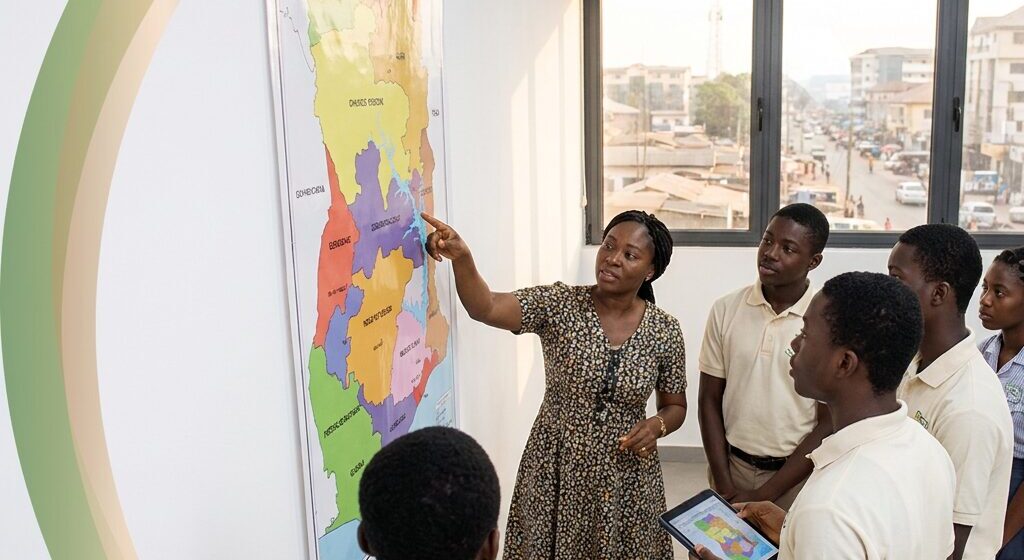
Ghana has 16 administrative regions, subdivided into a total of 261 districts, according to the Ministry of Foreign Affairs[1]. The count rose from ten after the referendum of 27 December 2018, when all six proposed new regions were approved[2]. Four existing regions were split to create those six, and the new regions took legal effect through constitutional instruments presented between 12 and 15 February 2019[3,4,5].
Updated October 2026
Region lists online contradict each other: some still show abolished regions, and published district totals do not agree. This page gives one correct, dated list with capitals, sizes and populations, and explains the differences instead of hiding them.
How many regions does Ghana have today?
The Ghana government’s own statement puts the country at 16 administrative regions with 261 districts beneath them[1]. The Permanent Mission of Ghana to the United Nations describes the same structure of sixteen regions further divided for administrative purposes into 261 local districts[6]. Regions are the first level of subnational administration in the Republic of Ghana, and local assemblies sit under them.
The number used to be ten. The change ran under Article 5 of the 1992 Constitution: a commission of inquiry chaired by Justice S. A. Brobbey examined the petitions, voters in the proposed regions approved all six in referendums on 27 December 2018[2], and the then president Nana Addo Dankwa Akufo-Addo created the regions by constitutional instrument in February 2019. Many lists still carry Brong Ahafo as a current region, and as at October 2026 even the Ministry of Foreign Affairs and Ghana mission pages cited here still show Brong Ahafo with Sunyani in their capitals lists[1,6], which is why two lists of Ghana’s regions can look completely different.
What are the 16 regions of Ghana and their capitals?
This table puts the capital, the 2021 census population and the land area in one place, in alphabetical order, with a note on whether the region comes from the former ten or the newer six. Populations are the final 2021 census counts from the Ghana Statistical Service[7], land areas are the Ghana Statistical Service census figures[8], capitals follow the Ministry of Foreign Affairs list[1] and the new regions are those created by the 2019 constitutional instruments[3].
| Region | Capital | Population (2021) | Area (km2) | Status |
|---|---|---|---|---|
| Ahafo | Goaso | 564,668 | 5,196 | New six |
| Ashanti | Kumasi | 5,440,463 | 24,389 | Former ten |
| Bono | Sunyani | 1,208,649 | 11,113 | Former ten (renamed remainder of Brong-Ahafo) |
| Bono East | Techiman | 1,203,400 | 23,248 | New six |
| Central | Cape Coast | 2,859,821 | 9,826 | Former ten |
| Eastern | Koforidua | 2,925,653 | 19,323 | Former ten |
| Greater Accra | Accra | 5,455,692 | 3,245 | Former ten |
| North East | Nalerigu | 658,946 | 9,070 | New six |
| Northern | Tamale | 2,310,939 | 26,524 | Former ten |
| Oti | Dambai | 747,248 | 11,066 | New six |
| Savannah | Damongo | 653,266 | 34,790 | New six |
| Upper East | Bolgatanga | 1,301,226 | 8,842 | Former ten |
| Upper West | Wa | 901,502 | 18,476 | Former ten |
| Volta | Ho | 1,659,040 | 9,504 | Former ten |
| Western | Takoradi (Sekondi-Takoradi) | 2,060,585 | 13,842 | Former ten |
| Western North | Sefwi Wiawso | 880,921 | 10,079 | New six |
Two naming notes save a lot of confusion. The Western Region capital is the twin city of Sekondi-Takoradi[1], so Takoradi on some lists is shorthand for the same place. Sunyani, once the capital of Brong-Ahafo, is now the capital of Bono, because the then Brong-Ahafo Region was divided into Bono, Bono East and Ahafo[9].
Which six regions were created, and where did they come from?
The six newer regions were carved out of four existing regions rather than added on top of the old map. The then Brong-Ahafo Region was divided into Bono, Bono East and Ahafo. The then Northern Region was divided into Northern, North East and Savannah. The then Volta Region was divided into Volta and Oti, and the then Western Region was divided into Western and Western North[3,9].
Each new capital was named when its constitutional instrument was presented: North East (Nalerigu, CI 116) and Savannah (Damongo, CI 115) on 12 February 2019; Bono East (Techiman, CI 113) and Ahafo (Goaso, CI 114) on 13 February 2019; and Oti (Dambai, CI 112) and Western North (Sefwi Wiawso, CI 117) on 15 February 2019[4,5,10,11,12].
Say you count it through from the old map. Before the vote there were 10 regions: Greater Accra, Ashanti, Northern, Volta, Eastern, Western, Upper-East, Upper-West, Central and Brong Ahafo[1,3]. Four of those were split and six were left untouched, so 6 + 3 + 3 + 2 + 2 = 16.
That is the step most pages skip, and it explains why Brong Ahafo disappeared from the list instead of simply shrinking.
What happened in the 27 December 2018 referendum?
The referendum on the creation of six new regions was held on December 27, 2018, and all proposed new regions were approved[6]. It was not a simple announcement: the process ran under Article 5 of the 1992 Constitution, through a commission of inquiry and then the referendum, which was limited to voters in the proposed new regions[13]. The Electoral Commission declared the results on 28 December 2018, and each proposed region passed both thresholds of 50% of registered voters voting and 80% of valid votes in favour[2]. The regions were then legally created by constitutional instruments CI 112 to CI 117, made on 1 February 2019 and presented between 12 and 15 February 2019[3,4,5,11], so correct sources may give 2018 (the vote) or 2019 (legal creation).
If you are answering an exam or report question about the count in 2018, be precise about timing: the country entered that year with ten regions, the referendum at the end of December approved six more, and they took legal effect in February 2019.
How many districts sit under the regions, and why do sources differ?
This is where published figures split, and it trips up students, teachers and researchers more than anything else on the topic.
| Source | Figure given | Wording used | Date checked |
|---|---|---|---|
| Ministry of Foreign Affairs (Ghana government) | 261 districts[1] | subdivided into a total of 261 districts | October 2026 |
| Permanent Mission of Ghana to the United Nations | 261 local districts[6] | sixteen regions, further divided into 261 local districts | October 2026 |
| Wikipedia | 260 assemblies[14] | as of 2020, 260 local metropolitan, municipal and district assemblies | October 2026 |
| Fact-Check Ghana | 216 districts[15] | further divided into 216 local districts for administrative purposes | October 2026 |
| VillaSharks | 216 local districts[16] | about 16 regions, further divided into 216 local districts | October 2026 |
Use the Ghana government figure from the Ministry of Foreign Affairs as your headline district count. The total reached 261 when the Guan District in the Oti Region was inaugurated in October 2021[17], and the Ghana News Agency was still reporting 261 metropolitan, municipal and district assemblies across the 16 regions in July 2026[18]. The Wikipedia figure of 260 is tagged as of 2020, before the Guan District was added. The 216 figure is out of date and should not be copied into schoolwork or a report.
The deeper reason the numbers move: a region is a fixed administrative tier, while a district is a local assembly that government can create, merge or elevate to municipal or metropolitan status. Counting assemblies in different years gives different totals. Constituencies are different again, because they are electoral areas rather than local government units.
Which is the largest region in Ghana?
It depends on whether you mean land or people, and the two answers are not the same.
- By land area: Savannah, with capital Damongo, has the largest area in the regional table, at 34,790 km2[8].
- Smallest by land area: Greater Accra covers 3,245 km2[8].
- By population: Greater Accra recorded 5,455,692 people in the 2021 census, just ahead of Ashanti on 5,440,463[7].
So if a teacher or an examiner asks for the largest region, the safe answer names both measures: Savannah by land area and Greater Accra by population. Writing only one of them is how marks get lost.
How did Ghana’s regional map change before 2018?
| Period | Number of regions | Change recorded |
|---|---|---|
| March 1957, independence | Five | The Northern Territories, Ashanti, Trans-Volta Togoland and the Gold Coast came together to form Ghana[14] |
| 4 April 1959 | Increased by one | Ashanti split into Ashanti and Brong-Ahafo[14] |
| 1 July 1960, republic day | Seven | Northern Region split into Northern and Upper regions[14] |
| Before the 1970 census (Second Republic) | Eight | Western Region split into Western and Central regions[14] |
| 23 July 1982 | Nine | The Greater Accra Law (PNDCL 26) created the Greater Accra Region[14] |
| 1983 | Ten | Upper Region divided into Upper East and Upper West[14] |
| 1987 | Ten | The former ten regional boundaries were officially established when Upper West was inaugurated[6] |
| 27 December 2018 | Ten (six approved) | Referendum approved all six proposed new regions[2] |
| February 2019 | Sixteen | Constitutional instruments CI 112 to CI 117, made on 1 February and presented from 12 to 15 February, created the six new regions[3,4,5,11] |
One date is genuinely unsettled. The Ghana mission page says the Upper West Region had already functioned as an administrative unit since the break-up of the Upper Region in December 1982, before the 1984 national census[6]. Wikipedia dates that division to 1983[14]. If the date matters for an assignment, name the source you followed and note the difference.
How can you tell a correct regions list from a stale one?
Region lists get copied for years without checking, so run this quick test before you trust one:
- Does it have exactly sixteen rows?
- Does it include Bono with Sunyani as capital?
- Does it exclude Brong Ahafo, which was replaced by Bono, Bono East and Ahafo?
- Does it include Oti with Dambai as capital?
- Does it include Savannah with Damongo as capital?
- Does it give a district count with a named source and a date?
- Does it give the referendum date of 27 December 2018 and, if it says 2019, tie that to the February 2019 constitutional instruments?
A list that fails two or more of these is usually an old copy. Regional minister names are a separate trap, because they change with every government and every reshuffle, so treat any minister list as a dated snapshot rather than a standing fact.
Where can you check the official figures and find a map?
- Ministry of Foreign Affairs, Regions page: the Ghana government statement on the number of regions and districts, best for the headline count.
- Permanent Mission of Ghana to the United Nations: carries a Ghana map and regions page, and records the pre-2018 history of the ten regional boundaries.
- Wikipedia, Regions of Ghana: useful for the history of each split, including the Brong Ahafo Region Act No. 18 of 1959[14]. Its Greater Accra population (5,445,692) is a typo for the census figure of 5,455,692[7] and its Northern land area (26,534 km2) differs from the Ghana Statistical Service figure of 26,524 km2[8], so check figures against the census tables.
No official one-page PDF of the regions and capitals is offered for download, so the practical route is to print the table above or paste it into a document. It already carries capitals, populations and areas, which is more than a plain name list gives you.
Try this today
Copy the region table into a one-page document, sort it alphabetically for study and by population for a presentation, then write today’s date on the sheet so you know when it was last checked. Then make it useful: if you need a service in a specific region, start with a region-level list such as the DVLA-approved driving schools in Bono Region, the driving schools in Central Region around Cape Coast, the Upper East list based in Bolgatanga, the Northern Region list based in Tamale or the Upper West list based in Wa.
Diaspora readers who need consular help can start from the embassies and diplomatic missions directory, and anyone moving goods between regions can use the transport and logistics listings.
Frequently asked questions
How many regions did Ghana have in 2018?
Ghana began 2018 with ten regions: Greater Accra, Ashanti, Northern, Volta, Eastern, Western, Upper-East, Upper-West, Central and Brong Ahafo[1,3]. The referendum on creating six new regions was held on December 27, 2018, and all the proposals were approved[6]. So the year started with ten and ended with the decision that produced today’s total of sixteen regions, which took legal effect through constitutional instruments in February 2019[4,5].
Are the 16 regions and their capitals available as a PDF?
No single official one-page PDF of the regions and their capitals is published for download, which is why the search keeps returning blog copies that are out of date. The practical route is to print or save the region table on this page, which carries the capital, the 2021 population and the land area for each region, then note the date you checked it.
Which government body publishes the official list of Ghana’s regions?
The Ministry of Foreign Affairs publishes the Ghana government statement that the country is divided into 16 administrative regions, subdivided into a total of 261 districts[1]. The Permanent Mission of Ghana to the United Nations states the same structure and also carries a regions map[6]. Treat the ministry page as your primary reference and the mission page as corroboration.
Why do sources quote 261, 260 and 216 districts for the same regions?
Because they count different things in different years. The Ministry of Foreign Affairs gives 261 districts[1], matching the Ghana mission’s 261 local districts. Wikipedia counts 260 metropolitan, municipal and district assemblies as of 2020[14]. Two older explainer pages give 216 local districts[15,16], which is out of date. The 261 total dates from the Guan District inauguration in October 2021[17] and was still the reported count in July 2026. Assemblies can be created, merged or upgraded, so totals move; follow the government figure.
Are regions the same as districts or constituencies in Ghana?
No. Regions are the first level of subnational government administration in the Republic of Ghana, and districts sit beneath them, numbering 261 on the Ministry of Foreign Affairs page[1]. Districts operate as metropolitan, municipal and district assemblies. Constituencies are different again: they are electoral areas used for parliamentary elections rather than local government units, so their count does not match the district count.
What were the 10 regions of Ghana before 2018?
They were Greater Accra, Ashanti, Northern, Volta, Eastern, Western, Upper-East, Upper-West, Central and Brong Ahafo[1,3]. Those boundaries were officially established in 1987, when the Upper West Region was inaugurated as the state’s newest administrative region[6]. Brong Ahafo no longer exists as a region, so any current list that still shows it with Sunyani as capital is out of date[9].
Sources
- Ghana government – Regions – Ministry Of Foreign Affairs
- Graphic Online – CONFIRMED: Results of the 2018 Referendum on new regions (28 Dec 2018)
- GhaLII – Oti Region Instrument, 2019 (C.I. 112) and the companion Region Instruments, 2019: C.I. 113 Bono East, C.I. 114 Ahafo, C.I. 115 Savannah, C.I. 116 North East and C.I. 117 Western North (made 1 Feb 2019)
- Graphic Online – Nalerigu is capital of North East region (12 Feb 2019)
- Graphic Online – Dambai becomes Oti regional capital (15 Feb 2019)
- Ghanamissionun – Map & Regions in Ghana – Ghana Permanent Mission to the United Nations (13 Oct 2026)
- Ghana Statistical Service – 2021 Population and Housing Census, General Report Volume 3B: Age and Sex Profile, Tables 5.2 to 5.17 (Nov 2021)
- Ghana Statistical Service – 2021 Population and Housing Census, Volume 1: Preliminary Report, Table 4 (land area by region) (Sep 2021)
- Graphic Online – Brong Ahafo to be known as Bono Region (15 Feb 2019)
- 3News – Akufo-Addo names Damongo as capital of Savannah Region (12 Feb 2019)
- Graphic Online – Ahafo, Bono East regions receive legal backing (14 Feb 2019)
- 3News – Sefwi-Wiawso named capital of Western North region (15 Feb 2019)
- Graphic Online – Publish Brobbey report on creation of new regions (3 Dec 2018)
- Wikipedia – Regions of Ghana (27 Jun 2026)
- Fact Checkghana – 16 Regions in Ghana (13 Aug 2024)
- Villasharks – 16 REGIONS OF GHANA: HOW MANY STATES ARE IN GHANA? (31 Oct 2023)
- Graphic Online – Guan District inaugurated (11 Oct 2021)
- Ghana News Agency – Bia East District Assembly tops national MMDA performance league table (10 Jul 2026)